The Ox-Wagon N1: Following the Forgotten Wagon Routes of the Southern Cape
Long before modern highways crossed the Southern Cape, ox wagons followed narrow mountain tracks linking the coast with the Klein Karoo. Exploring Gysmanshoek and Attaquaskloof reveals remarkable scenery, forgotten settlements, old forts, ancient wagon routes and the stories of the people who travelled them.
Some roads take you somewhere. Others take you back in time.
Long before modern highways crossed the mountains of the Southern Cape, people travelled between the coastal plains and the interior along narrow tracks through the Langeberg and Outeniqua mountains.
For the early wagon travellers, these mountains were enormous obstacles. There were no engineered roads, no bridges across every river and certainly no roadside assistance when things went wrong.
An ox wagon was slow, heavy and not particularly fond of steep mountain slopes.
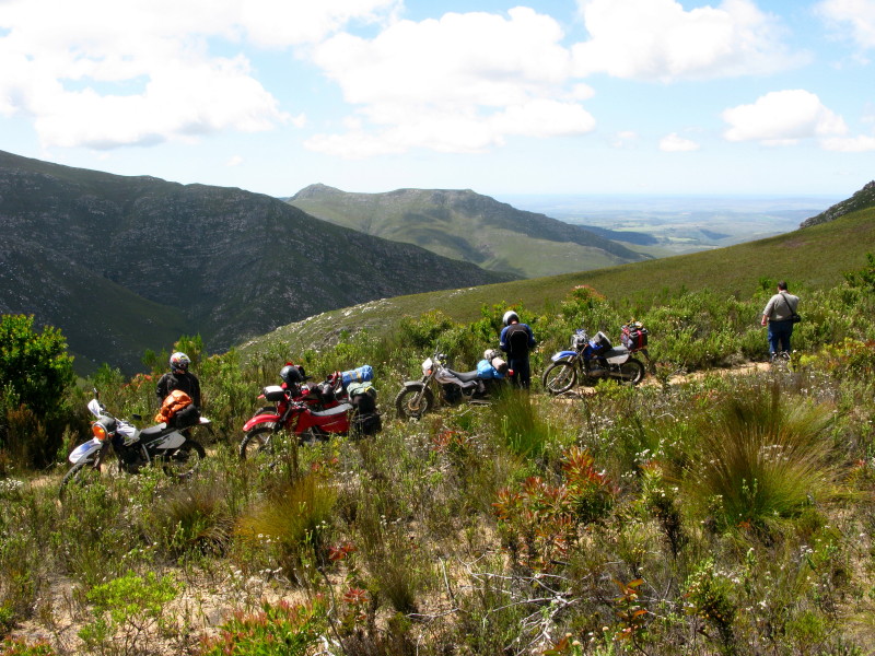
Today we travel many of these routes for pleasure, on motorcycles or in 4x4s, enjoying the scenery and the solitude.
The people who went before us didn’t always have that luxury.
And it is worth remembering that many of the early wagon routes followed much older paths used by indigenous communities and wildlife, particularly elephants.
There is a name I like to use for a modern adventure route linking some of these historic mountain crossings.
The Ox-Wagon N1.
Not an official highway, of course, but a journey through the forgotten road network that once connected the Southern Cape with the Klein Karoo.
Gysmanshoek: Across the Langeberg
Our journey starts near Heidelberg, where Gysmanshoek Pass crosses the Langeberg mountains into the Klein Karoo.
Compared with some of the other old mountain passes, Gysmanshoek is a relatively gentle affair.
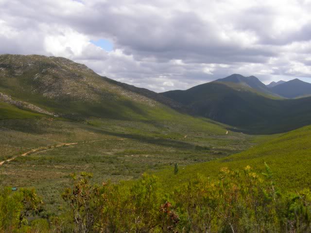
The gravel road climbs through beautiful countryside, passing farms and eventually entering the mountains.
As you gain altitude, the landscape begins to change. The green coastal vegetation gradually makes way for the drier country on the northern side of the Langeberg.
The road winds through a beautiful valley, with fynbos-covered slopes rising on either side.
And then there is that wonderful quietness.
No traffic jams. No hurry. No reason to be anywhere else.
The forgotten Plattekloof crossing
For years, the history of Gysmanshoek was closely associated with the older Plattekloof Pass.
Many writers treated them as different names for essentially the same route.
But research by Niel van Wyk, published in 2023, provides compelling evidence that they were two separate mountain crossings.
Plattekloof lay west of the Plattekloof River and was already being used by European travellers in the eighteenth century. The route itself had much older origins as an animal and indigenous travel path.
Gysmanshoek Pass, on the eastern side of the river, was constructed in 1841, with part of its alignment improved in 1860.
It is an important distinction.
The original Plattekloof route was effectively abandoned when the newer Gysmanshoek crossing was developed.
Famous travellers such as Carl Thunberg, Robert Jacob Gordon and William Paterson crossed the Langeberg in this area during the eighteenth century.
Paterson’s account of the summit describes an expansive view towards the Indian Ocean on one side and Kannaland on the other.
I love that.
More than two centuries later, you can still stand in these mountains and appreciate what impressed those early travellers.
But there is another question.
Why did Gysmanshoek eventually lose its importance?
When distance was measured in days
A glance at a map provides part of the answer.
For people living around Swellendam, travelling east towards Gysmanshoek or west towards Cogmanskloof could mean considerable extra distance before they even crossed the mountains.
And when your transport depended on oxen, distance meant time, grazing, water and expense.
The opening of Port Beaufort to shipping in 1841 increased the demand for practical routes between the Klein Karoo and the coast.
Improved passes eventually provided better alternatives.
The Tradouw Pass opened in 1873, followed by Garcia’s Pass in 1877.
Gysmanshoek gradually became a quieter back road.
It was not entirely forgotten, though.
During the Anglo-Boer War, Boer commandos familiar with the country could use these lesser-known crossings to evade pursuing British forces.
One account describes a commando escaping through Gysmanshoek after an attack on British positions at the Masonic Hotel in Heidelberg in September 1901.
What was once a transport route had become a useful escape route.
Today, fortunately, the attraction is rather more peaceful.
Eastwards towards Attaquaskloof
From Gysmanshoek, the Ox-Wagon N1 continues eastwards through the Klein Karoo.
The gravel roads take us across the Gourits River towards Cloetes Pass and Herbertsdale.
But before reaching Cloetes Pass, another historic route branches away towards Attaquaskloof.
An unassuming ox-wagon sign marks the turn-off.
You could easily miss it.
And that would be a pity, because beyond that little sign lies one of the most remarkable old mountain crossings in the Southern Cape.
Attaquaskloof: A valley with a violent history
I have travelled through Attaquaskloof on motorcycles and in a 4×4, returning on different occasions to explore its roads, scenery and history.
Each visit revealed something new.
One of the most memorable was an October 2012 expedition in the Arctic Hilux.
We had run out of time during the previous day’s journey, so Kane and I returned to Bonniedale to complete the crossing.
Nico and Danette Hesterman helped us with the necessary access arrangements and gate keys.
Back then, the route passed through the Attakwas Nature Reserve, and access was controlled.
It was not the sort of place where you simply arrived and drove wherever you pleased.
And the route wasted little time reminding us why a suitable vehicle was necessary.
We started in a riverbed.
From there, we crossed a stretch of sand before reaching a steep, rocky climb.
On an earlier visit, tackling those hills on trail bikes had required rather more determination.
Inside the Arctic Hilux, with its enormous tyres and considerable ground clearance, the same obstacles felt almost unfairly easy.
As a motorcyclist, it felt a little like cheating.
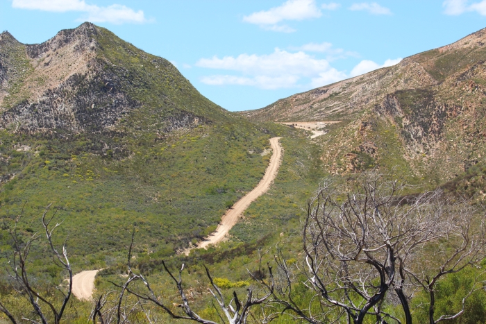
Once we reached the higher ground, the route became easier and the scenery opened up.
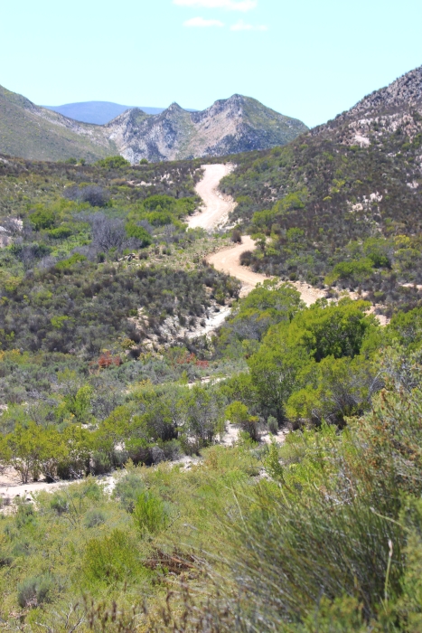
The track wound between hills, climbed into the mountains and dropped into little valleys.
At almost every turn there was another view demanding a photograph.
No fences. Hardly another soul.
Just a trail through the African mountains.
This is the kind of travelling I love.
But there is much more to Attaquaskloof than beautiful scenery.
Long before the wagons
The routes through these mountains were known to people long before European explorers arrived.
San hunter-gatherer communities and Khoekhoen pastoralists moved through the landscape, using established paths between the coast and the interior.
The Attaqua, a Khoekhoen community associated with this region, gave their name to the kloof.
There are traces of earlier occupation in the surrounding mountains, including rock art.
The recorded history of European travel through Attaquaskloof begins in 1689, but the route itself is much older.
The mountains were not unknown or uninhabited territory.
In fact, without the knowledge of local people and the existing paths, the early European expeditions would have faced even greater difficulties.
Isaac Schrijver and the first recorded wagon crossing
In January 1689, Ensign Isaac Schrijver led an expedition into the interior on behalf of the Dutch East India Company.
The party included 21 armed Europeans, Khoekhoen guides and two ox wagons.
Its objective was to obtain livestock for the Cape settlement.
Schrijver’s expedition travelled eastwards towards the Mossel Bay area before turning inland through the Outeniqua Mountains.
The party followed an existing route associated with local communities and the movement of elephants.
The vegetation was dense and the terrain difficult.
Sections of the track had to be cleared or widened to accommodate the wagons.
The crossing required considerable physical effort, and the expedition’s experiences demonstrated just how challenging travel through these mountains could be.
Schrijver’s journey also became associated with violent encounters with Khoekhoen communities during the expedition.
The details survive largely in colonial records, but they remind us that the opening of new trading routes was not simply a romantic story of exploration.
Trade, competition for livestock and conflict were part of this history.
The route nevertheless became an important link between the Southern Cape coast and the Klein Karoo.
And for generations, travellers and traders followed it.
A valley that once did business
It is hard to imagine today, but this lonely mountain country once supported activity associated with a busy transport route.
Ox wagons carried goods across the mountains. Farmers travelled to markets. Traders moved between settlements, and places developed where travellers could rest, obtain supplies and prepare for the next difficult section.
One of the names that survives in this story is Woeska.
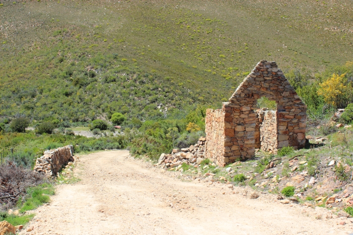
The remains of the old settlement were still visible during our earlier visits.
It is a remarkable feeling to stand among the ruins of a place where people once lived and worked.
You look at the remains of a wall or doorway and wonder what the buildings looked like when the road was busy.
Who lived here?
Who stopped to trade?
And how many travellers spent a night here before continuing across the mountains?
Today, the old buildings are little more than fragments of another time.
The deterioration of the ruins is a reminder that history does not preserve itself.
Sometimes, once a building is gone, all that survives is a name and a handful of photographs.
Bonniedale and the old toll route
Our 2012 journey continued through Bonniedale, a property with its own long association with the old pass.
According to the local history recorded during our visit, a Scottish settler established himself here in 1860.
He held a toll concession to maintain part of the route towards the summit and supplied animals and provisions to passing travellers.
Mules, oxen and food were valuable commodities on a difficult mountain crossing.
The remains associated with the old toll route are among the reminders that this was once a working road, not an adventure trail created for modern vehicles.
Every wagon that passed through represented somebody’s livelihood, a journey to market or a long trip between settlements.
And some journeys would have been considerably less comfortable than ours.
A monument in the mountains
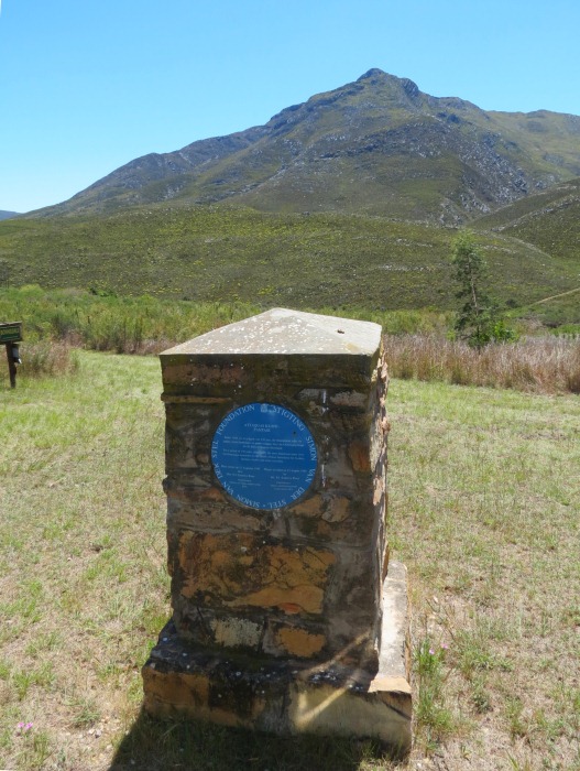
One of the most interesting stops along the route is the historic Attaquaskloof commemorative monument.
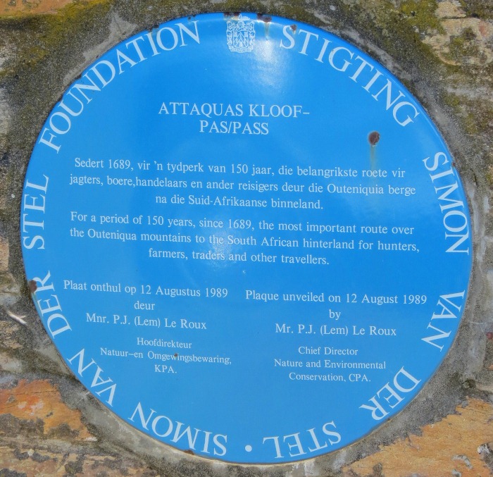
The surrounding mountains provide a dramatic backdrop, but it is the blue plaque that holds your attention.
The plaque was unveiled on 12 August 1989 by P.J. (Lem) le Roux.
It commemorates the importance of Attaquaskloof as a route across the Outeniqua Mountains from 1689 onwards.
According to the inscription, the crossing served hunters, farmers, traders and other travellers for approximately 150 years.
Standing there, surrounded by mountains, it is easy to understand why the road deserves to be remembered.
The monument marks more than the history of transport.
It marks the people whose lives were shaped by this mountain crossing.
The aloe kraal
Not far from the commemorative monument, we came across something that I find especially fascinating.
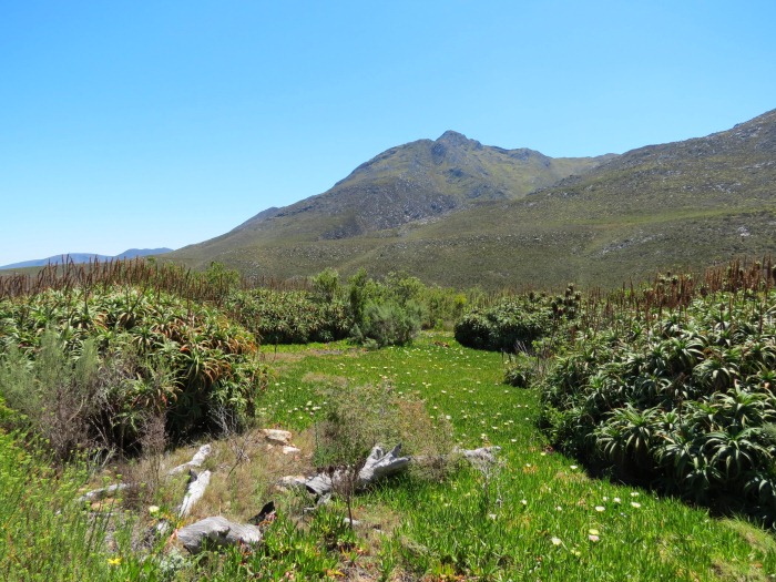
An old kraal formed by planting aloes.
According to the local explanation of the site, oxen were kept inside this living enclosure overnight.
It is such a simple idea.
Instead of building an elaborate structure, the travellers or people associated with the route made use of the hardy vegetation of the area.
And generations later, traces of the enclosure were still there.
I have often wondered how many exhausted teams of oxen spent a night in that kraal.
How many fires were lit nearby?
How many drivers sat around them, discussing the following day’s journey?
The most extraordinary thing about places like this is not always what you can see.
It is what you can imagine once you know what you are looking at.
Bloubaard and the darker stories of the kloof
The valley also has its darker stories.
One of the best known concerns a man called Bloubaard Swanepoel.
According to local tradition, he was buried somewhere near the old hiking hut, close to a large tree.
On one of our visits, we tried to identify the place associated with his unmarked grave, but the area had become overgrown.
Bloubaard was remembered as a cattle trader and murderer.
The story goes that he would sell cattle, ambush the purchasers as they travelled through the mountains, kill them and recover the animals to sell again.
He was eventually convicted and publicly executed in George.
Some retellings describe him as the last man publicly hanged in South Africa, but that broader claim is not securely established.
His connection with the area, however, remains part of the oral history of Attaquaskloof.
Other stories accuse him of murdering labourers after they had collected honey from dangerous cliffs along the Gourits River.
Those accounts are difficult to verify and should be understood as local tradition rather than proven incidents.
Yet even allowing for the exaggeration that sometimes accompanies stories passed down through generations, Bloubaard’s reputation was a grim one.
It is difficult to reconcile such tales with the peace and beauty of the mountains.
But that contradiction is part of the story of this place.
A fort overlooking the old road
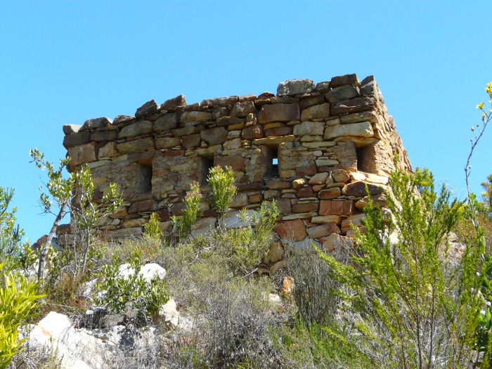
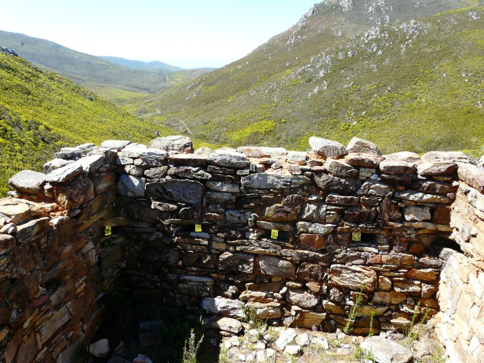
Climbing higher through the pass, the remains of a small stone fort stand near the old route.
The structure has traditionally been identified as a British military position dating from the Anglo-Boer War.
Its location makes perfect sense.
From here, anyone occupying the position would have had an excellent view of travellers approaching along the mountain track.
Even though the old wagon route had lost its commercial importance after Robinson Pass opened, the mountain crossing remained strategically interesting.
During the Anglo-Boer War, the knowledge that Boer commandos possessed of the lesser-used passes was a concern for British forces.
Whether this particular fort ever saw fighting is another question.
But the surviving stonework is a striking reminder that the old road was still important long after its busiest trading days were over.
Over the summit
The journey continues upwards.
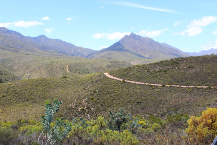
The scenery becomes increasingly impressive as the track climbs towards the summit.
On a clear day, the views stretch across the surrounding ranges towards the coast.
Then the road begins its descent into the Klein Karoo.
The landscape changes again.
The vegetation becomes thicker in places, and the mountains gradually give way to the more open country beyond.
This is one of my favourite aspects of mountain passes.
You can leave one landscape behind and enter a completely different one in the space of a few kilometres.
Saffraanrivier: The remains of another world
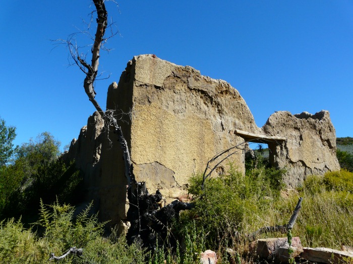
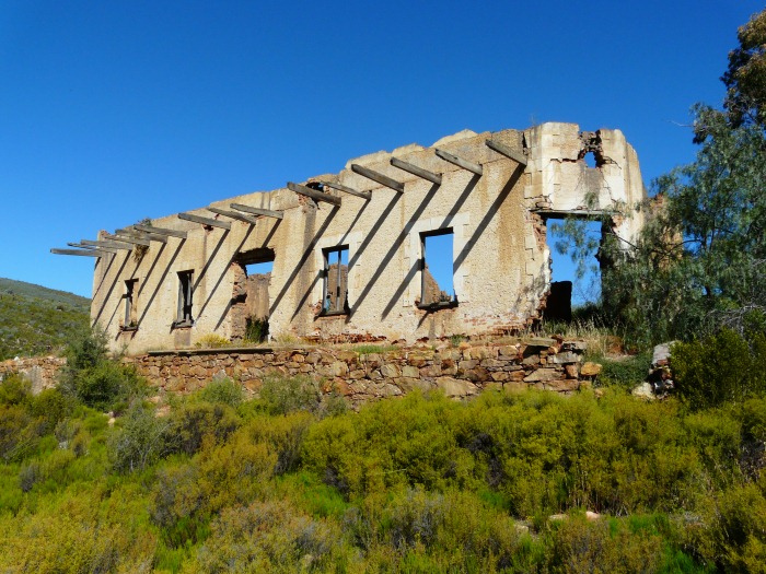
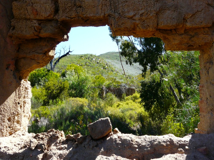
On the Klein Karoo side of the mountains, near Saffraanrivier, are the remains of another old settlement.
During our visits, we explored several substantial stone buildings and other ruins.
Local accounts describe a former hotel and general dealer that once served travellers on the mountain route.
The hotel was said to have been called Die Bonthuis.
There are also stories of a murder and a suicide connected with the old establishment, although I have not found documentary evidence to establish those events.
Walking among the buildings raises all sorts of questions.
Some of the walls are constructed from stone, clay and rubble.
Other sections show evidence of later alterations, with bricks added to earlier structures.
One doorway and the decorative surrounds of the windows suggest that at least one building may have served a commercial purpose.
Another structure appears to have had a large open courtyard in front of it.
Was that where the ox wagons were parked?
Was it a loading area?
Perhaps a gathering place where travellers waited while their animals rested?
Without further archival evidence, we cannot say for certain.
But the ruins make it easy to imagine a time when the valley was considerably busier than it is today.
And that, more than anything, is what fascinates me about old settlements.
When the traffic moved elsewhere
Attaquaskloof remained an important transport crossing for generations.
But in 1869, the opening of Robinson Pass provided a more practical route between Mossel Bay and the Klein Karoo.
The old wagon road gradually lost its commercial importance.
The traffic moved elsewhere.
The trading places declined.
And nature slowly began reclaiming the road and the buildings along it.
Today the ruins, old enclosures and mountain tracks are reminders of a route that once played an important part in the development of the Southern Cape.
They are also reminders of the people whose lives were tied to it.
The indigenous communities who knew these mountains long before wagons crossed them.
The explorers and traders.
The farmers and wagon drivers.
The labourers who maintained the roads.
And the people who lived in the little settlements that have almost disappeared.
Why the old roads still matter
We have travelled a long way from the days of ox wagons.
A modern vehicle can cross the mountains in a fraction of the time.
But faster travel does not necessarily mean that we experience more.
Sometimes it means we simply pass more places without really seeing them.
That is why I enjoy travelling the old roads.
You stop.
You look around.
You notice a stone wall, an old tree or the remains of a building.
And then you begin asking questions.
Who built this?
Why was it here?
What happened to the people who lived here?
The answer is often a story far more interesting than the road itself.
The Ox-Wagon N1 is not just a collection of mountain passes.
It is a journey through the history of the Southern Cape.
And a reminder that some of the best discoveries happen when we leave the main road behind.
There are stories all around us.
We simply have to go looking for them.
Planning a visit
The journeys described in this article took place over several years, including our 2012 crossing of Attaquaskloof.
Access conditions have changed since then.
Mountain Passes South Africa reported in May 2017 that CapeNature had closed its section of the Attaquaskloof through-route to vehicles. It was still possible at that time to visit certain trails on Bonniedale, subject to the property’s arrangements.
Do not assume that the complete historic pass is open for driving. Obtain current confirmation and the necessary permission before planning a visit.
For further reading about the area’s historic roads, see Niel van Wyk’s research on Plattekloof Pass and Mountain Passes South Africa’s Attaquaskloof feature.
And if you enjoy discovering forgotten places by studying a map, read our story Viva die Papierkaart.
Editor’s note: This feature combines two original Ultimate Lifestyle articles with photographs and observations from earlier Trailrider Reports expeditions. Some historical anecdotes are recorded as local tradition rather than independently verified fact.