Beyond the Sign: Twelve Years to Vaandrigsdrif
A mysterious road sign beside the N2 led to a forty-minute detour, an eighteenth-century expedition, forgotten river crossings and a little stone cottage. Twelve years later, Johann van Tonder returned to finish the journey.
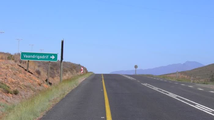
Somewhere west of Swellendam, beside the N2, there is a road sign I must have driven past hundreds of times.
Vaandrigsdrif.
Most motorists probably pass it without giving the name a second thought. But for me, it had been a source of curiosity for years.
I first noticed it in the early 1990s, while serving in the South African Air Force in the area. At the time, vaandrig was a rank used in the South African Navy, and I couldn’t help wondering what a naval rank was doing on a road sign hundreds of kilometres from the sea.
But it wasn’t only the name.
Just beyond the sign, a little road turned off the N2 and disappeared over a hill into the surrounding farmland.
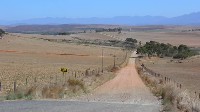
Where did it go? What was on the other side?
Every time I passed, I wondered about it. And every time, I simply carried on driving.
On 1 March 2012, I finally stopped.
Not to explore the road, not yet. Just long enough to photograph the sign and the road disappearing over the hill.
Then I got back into the vehicle and continued my journey.
A month later, I would finally take that turn.
The Day I Finally Turned Off
On 2 April 2012, everything finally fell into place.
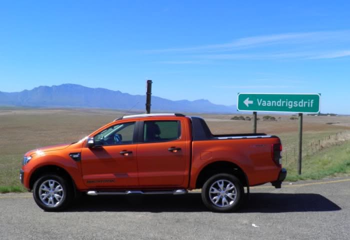
I had left early, traffic had been unusually kind, and the vehicle changeover in Cape Town had happened sooner than expected. The car I was supposed to collect wasn’t available, so I ended up with a Ford Ranger Wildtrak instead.
Not a bad substitute for someone with a gravel road on his mind.
Heading home, I approached the Vaandrigsdrif sign again. Only this time, there was no reason to drive past.
I had a little time to spare, a vehicle perfectly suited to gravel roads and a question that had followed me along the N2 for years.
So I turned off.
It wasn’t a carefully planned expedition. I had no particular destination, no route worked out and no idea what I might find on the other side of the hill.
The road might simply end at a farm gate.
But after years of looking at it from the N2, I was finally driving down it.
And for the first time, I was about to discover what lay beyond that hill.
A Forty-Minute Holiday
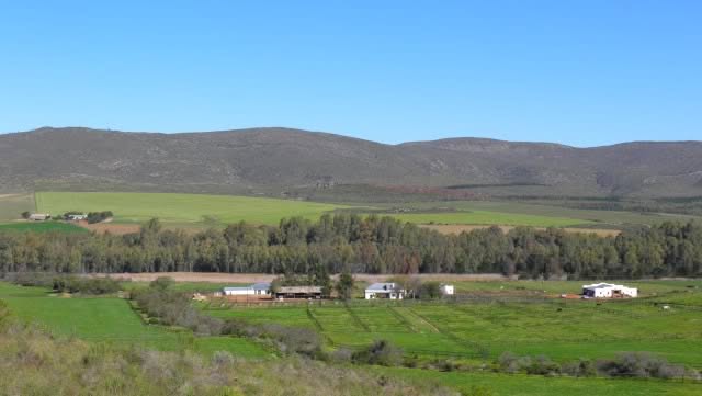
Once over the hill, the landscape opened up towards the Sonderend River, which wound its way through the farmland below.
This was the Overberg, a landscape that changes dramatically with the seasons. After the harvest, the fields are dusty brown. With the winter crops, they turn green, and when the canola flowers, whole stretches of countryside become a brilliant yellow.
In early April, the fields were still mostly brown, although patches of green were beginning to appear along the river.
I wished I was on my motorcycle. On a bike, you experience the countryside with all your senses, the wind, the temperature and the smells. But the Ranger wasn’t a bad substitute.
I rolled down the windows.
As I drove past the irrigated fields, the dry, dusty air gave way to that wonderful smell of wet earth. I stopped for a moment to enjoy it.
The road continued through the farmland towards a small plantation. Beyond it, signs clearly marked the property as private, with no entry permitted.
That was as far as I could go.
I took a few more photographs and turned around, stopping again on top of the hill to photograph the road from the opposite direction. It was the view I had been wondering about for years.
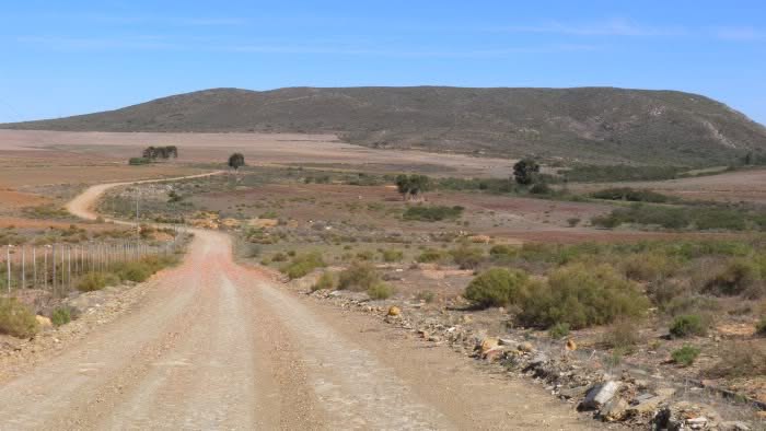
So what had I found on the other side?
Some people might have said nothing. Just a gravel road through the fields that eventually came to a dead end.
But I had found beautiful countryside, changing landscapes, the smell of wet earth and a view of a river valley I had only ever glimpsed from the N2.
I hadn’t reached the river, and I certainly hadn’t solved the mystery of Vaandrigsdrif.
But I had finally answered one question that had bothered me for years.
What lay beyond that hill?
And the whole adventure had taken less than an hour.
I had a 40 minute holiday.
The Ensign Behind the Name
The forty-minute detour may have been over, but my curiosity wasn’t.
Back home, I started looking more closely at the maps and researching the name Vaandrigsdrif.
That was when I came across August Frederik Beutler.
Beutler was a vaandrig, or ensign, in the service of the Dutch East India Company (VOC). In 1752, Governor Ryk Tulbagh placed him in command of an expedition to explore the country east of the Cape Colony.
The expedition left the Castle of Good Hope on 29 February 1752, with 71 people, eleven ox-wagons and even a boat to help them cross rivers.
This was no small undertaking.
The party included soldiers, wagon drivers, a surgeon, a botanist and several men tasked with recording their discoveries. Carel Albregt Haupt kept the official journal, while surveyor Carel David Wentzel mapped the route.
Their instructions were to investigate the geography, natural resources, inhabitants and trading possibilities of the country beyond the established colonial settlements.
The expedition travelled eastwards through the Southern Cape, past Mossel Bay, over the Outeniqua Mountains through Attaquaskloof and along the Langkloof. Eventually, they crossed the Kei River and reached the region of present-day Butterworth before turning back.
They returned to Cape Town on 6 November 1752, after more than eight months on the road.
The journal they left behind is one of the most important surviving eighteenth-century accounts of the Eastern Cape. It records a landscape, its wildlife and its inhabitants as encountered by an official VOC expedition, although the people living there had known the country for generations.
Suddenly, the name on that little road sign had a much bigger story behind it.
The naval-sounding title that had puzzled me for years wasn’t referring to a sailor at all, but to an ensign who had led an extraordinary overland journey more than 250 years earlier.
And the name Vaandrigsdrif suggested that somewhere along the Sonderend River, there might have been a crossing associated with his expedition.
But where exactly was it?
But Where Was the Drift?
The name was beginning to make sense. But there was still the question of the drift itself.
After my first little excursion, I studied the maps more closely.
The road I had followed from the N2 ended before reaching the Sonderend River. There was no crossing where I had been.
But on the other side of the river, another road led towards a place marked Vaandrigsdrif.
Could this have been the old crossing?
The historical records offered some intriguing clues.
On 17 March 1752, Beutler’s expedition reached a branch of the Sonderend River near Swellendam. Heavy rain had swollen the water, forcing the party to use the boat they had brought along for precisely this sort of obstacle.
Later that afternoon, they reached the residence of Swellendam’s landdrost, Jan Andries Horak.
It was a wonderful little detail. Imagine travelling through the Overberg with eleven ox-wagons, only to find the river in flood and having to ferry people and equipment across.
But the crossing described in the journal was near Swellendam. It did not establish the exact location of the place marked Vaandrigsdrif on my map.
Historical place-name research also connects Vaandrigsdrif with an early ferry crossing near the confluence of the Sonderend and Breede rivers.
So there were clues, but still no definite answer to where Beutler himself had crossed.
I began wondering about those old roads. How closely did the modern farm tracks follow the wagon routes of more than 250 years ago? Where had travellers crossed the river before bridges made journeys so much easier?
And, more immediately, what was at the end of that road on the opposite bank?
There was really only one way to find out.
I would have to go back and explore the other side of the river.
Exploring the Other Side
On 13 April 2012, less than two weeks after my first little excursion, another opportunity presented itself.
Once again, I was heading home from Cape Town with some time to spare. This time I was driving a GWM H5, and the search for Vaandrigsdrif was still very much on my mind.
I had been studying the maps, and it seemed the next logical step was to approach the river from the opposite side.
There was just one small problem. I had never travelled these particular roads before, and I had no detailed map or off-road GPS with me.
All I really knew was that I wanted to reach the other side of the Sonderend River.
So I turned off the N2 onto the R317 and crossed the river near Stormsvlei.
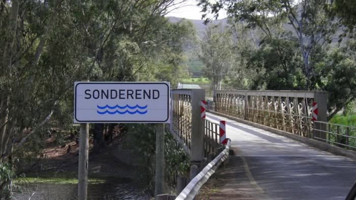
The countryside had changed considerably since my first visit. The winter crops were beginning to appear, and fields that had been dry and brown only weeks earlier were showing patches of green.
It was one of those wonderful Overberg days when even an unfamiliar farm road seems worth exploring.
The road wound through a poort and opened onto broad plains, with distant hills and farmland stretching away on either side.
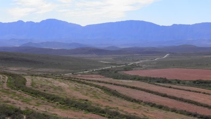
There were old farm buildings, abandoned structures and plenty of gravel roads disappearing into the surrounding countryside.
I had no particular reason to hurry, although I was still supposed to get home that afternoon.
Eventually, I stopped at a farmstead to ask about a road leading towards the river.
The owners were friendly and showed me the way.
And that was how, while looking for an old river crossing, I came across something I hadn’t expected at all.
A little stone cottage beside the Sonderend River.
Die Kliphuisie
There, beside the Sonderend River, stood a little stone cottage.
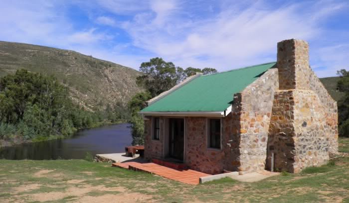
It was the last thing I had expected to find while searching for an old river crossing.
The cottage was available as self-catering accommodation, and the friendly farm owners were happy to let me have a look around.
It was a charming little place, with a double bed, sleeping space for children in the loft, a fireplace and everything needed for a comfortable stay.
There were even a couple of fishing rods for anyone who fancied trying their luck in the river.
But the real attraction was outside.
The cottage stood in beautiful surroundings, with the Sonderend River flowing nearby and the surrounding farmland stretching towards the hills.
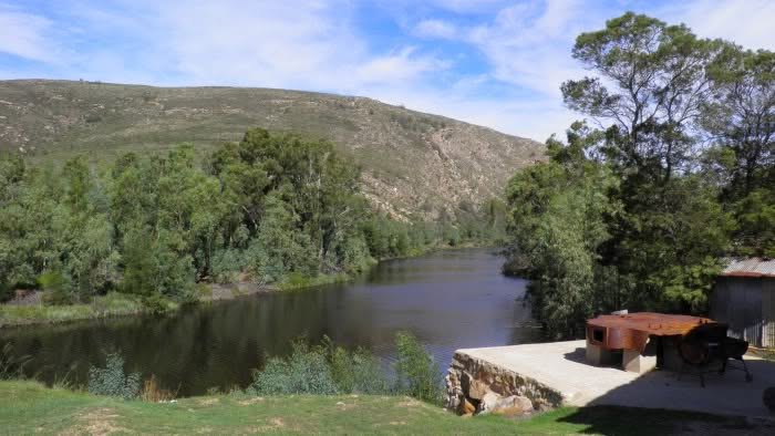
It was exactly the sort of place I enjoy discovering. Somewhere away from the busy roads and familiar tourist destinations, where you could spend a weekend exploring the countryside or simply doing very little.
I had set out to find Vaandrigsdrif, but instead I had stumbled upon somewhere I would happily bring the family for a few days.
And, as it turned out, I wasn’t even at Vaandrigsdrif.
The place I had been looking for was farther east.
Still, I wasn’t complaining.
I took photographs of the cottage and its surroundings, enjoyed the scenery and eventually had to turn towards home. My little detour had used up all the spare time I had available.
I hadn’t found the river crossing I was looking for.
But I had found Die Kliphuisie.
And it was a place I wouldn’t forget.
Following the Old Roads
Finding Die Kliphuisie had been an unexpected bonus, but there was still unfinished business.
I had set out to find Vaandrigsdrif, and I wasn’t quite ready to give up.
By August 2012, another opportunity to explore the area presented itself. This time I was driving a Dodge Journey, and I decided to approach the area from a different direction.
I followed the R317, crossing the Breede River and continuing through Hessekwasnek into the surrounding farmland.
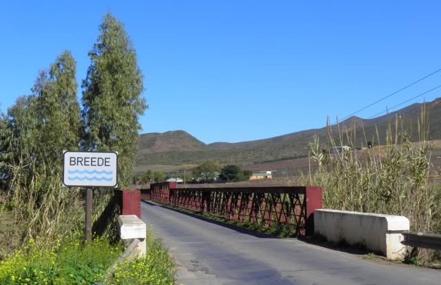
Recent rain had transformed the countryside. The fields were green, the rivers were running high, and the landscape looked very different from the dry farmland I had first photographed in March.
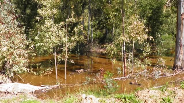
Once again, I found myself following unfamiliar gravel roads through the Overberg.
There were old farm buildings, forgotten tracks and roads that seemed to follow the natural contours of the land rather than any particular destination.
It was difficult not to wonder how much of this network had developed from the old wagon routes.
Before the bridges, travelling through this countryside was a very different undertaking. A river in flood could bring an entire journey to a halt, particularly when that journey involved heavily laden ox-wagons.
Eventually, I reached the Sonderend River again, this time in the vicinity of where my maps suggested the old Vaandrigsdrif crossing might have been.
The river was running high.
I looked at the landscape, the approaching roads and the opposite bank, trying to imagine where a wagon party might once have crossed.
It was tempting to think that I had finally found the place.
But there is a difference between finding a likely location on a modern map and establishing precisely where an eighteenth-century expedition crossed a river.
The original route may have changed. Riverbanks shift, old tracks disappear and new roads replace them.
I had followed the clues as far as I could.
Whether this was the exact crossing used by Beutler in 1752 remained an open question.
But I had explored another part of the Overberg, discovered more of its forgotten roads and added another chapter to a journey that had begun with a simple sign beside the N2.
And somewhere along the way, the little stone house beside the river had become part of that story too.
Twelve Years Later
Twelve years passed before I saw Die Kliphuisie again.
In that time, I had travelled thousands of kilometres, explored countless back roads and discovered many interesting places. But for some reason, that little stone cottage beside the Sonderend River had stayed with me.
Every now and then, I would think about it. I had always wanted to go back, not just for another quick visit, but to spend a few days there.
In 2024, I finally got the opportunity.
We were planning a short holiday and had a Suzuki Fronx available for the trip. This time, instead of simply following an unfamiliar road to see where it went, we had an actual destination.
We booked Die Kliphuisie for three days and two nights.
It was a very different journey from my first visit in 2012.
Back then, I had been exploring unfamiliar roads, trying to find a historical river crossing. Now I was travelling through countryside I had come to know, heading towards a place I remembered surprisingly well.
Some of the old roads looked much as they had twelve years earlier. I recognised familiar stretches of farmland, hills and buildings along the way.
And eventually, there it was.
Die Kliphuisie.
The little stone cottage looked much as I remembered it.
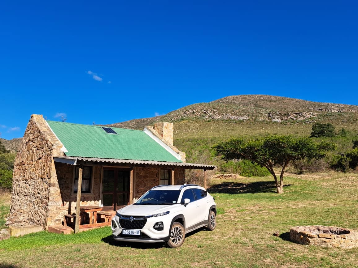
It was still a simple, comfortable place, with its stone walls, cosy interior and the Sonderend River nearby.
There was no particular itinerary for our stay. We spent our time enjoying the surroundings, exploring a little and simply relaxing.
Even the limited cellphone reception was a welcome change.
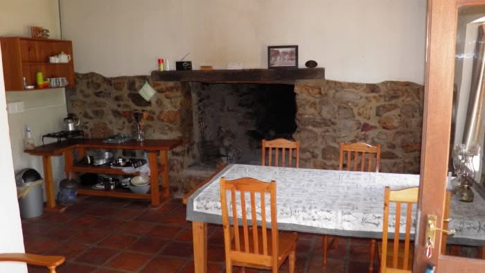
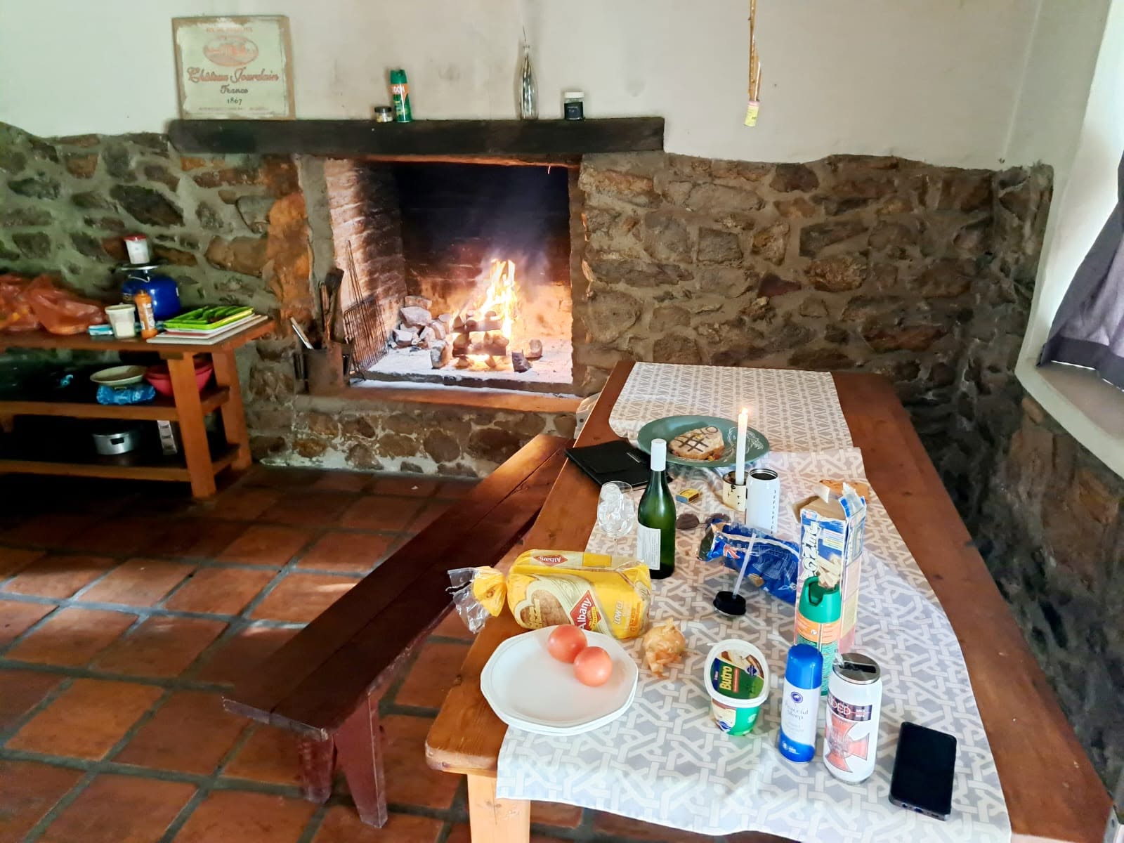
For once, there was no need to rush off to the next destination, no pressing schedule and no mystery that needed solving before we left.
The place I had discovered during a hurried detour twelve years earlier had become somewhere we could spend a few days doing very little.
And I was perfectly happy with that.
The Same Road, Twelve Years Apart
On our way out, I stopped beside an old, derelict farm building I remembered from my explorations in April 2012.
Back then, I had photographed the GWM H5 beside it.
Now, twelve years later, I stopped in almost the same spot to photograph the Suzuki Fronx.
Two very different vehicles, the same old building, and twelve years between the photographs.
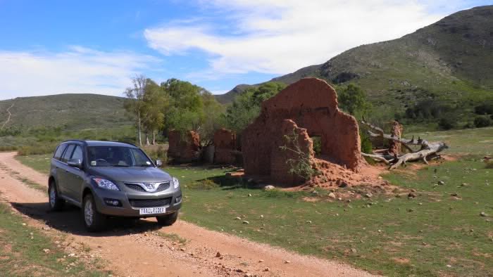
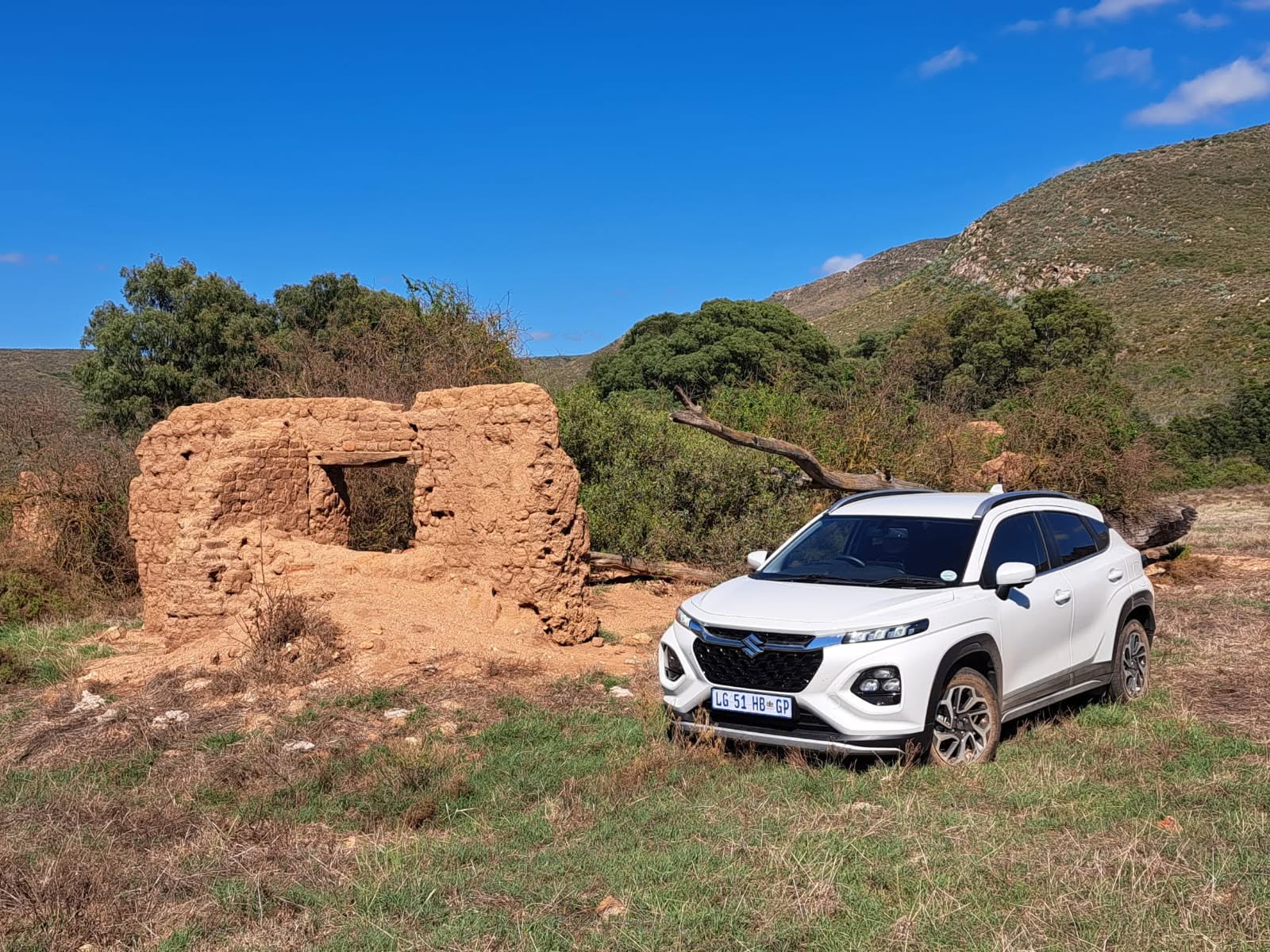
The building had deteriorated considerably. Time had clearly not been kind to it.
But the surrounding countryside was still much as I remembered. The same hills, the same farmland and those wonderful little roads that had first drawn me into this part of the Overberg.
Looking back, the whole Vaandrigsdrif adventure had turned out rather differently from what I expected when I first stopped beside the N2 in March 2012.
I had started with a road sign and a question about its name.
That led to an eighteenth-century expedition, old wagon routes, unfamiliar gravel roads, river crossings and a little stone cottage that I would eventually return to twelve years later.
I still cannot point to the exact place where Beutler crossed the Sonderend River and say with certainty that this was Vaandrigsdrif.
Perhaps further research will settle that question. Perhaps it won’t.
But I know considerably more about that stretch of countryside than I did before.
And whenever I pass the Vaandrigsdrif sign now, I no longer see just another road disappearing over a hill.
I remember the river, the old buildings, the Kliphuisie and all the little discoveries that began because, one afternoon, I finally decided to turn off the N2 and have a look.
Not bad for a forty-minute holiday.